Weather systems can be complex. They are constantly changing, with winds varying in strength and direction over time. Sailboats, of course, will speed up and slow down according to the wind speed and direction. Sailing upwind, downwind, or reaching all have quite different performance characteristics for a sailboat. Deciding how to navigate through a complex weather system can be difficult. Decisions made early in a passage could place boats in quite different locations later on. Deciding where to place yourself in the future so that you can take maximum advantage of the wind can be a complex task.
Consider a boat in Hawaii wishing to sail to the Pacific Northwest. A weather forecast has been downloaded which is showing the following conditions:
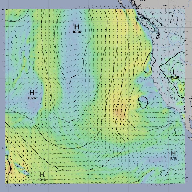

Two obvious choices are available. A direct great circle route between Hawaii and Neah Bay is the shortest distance. However, this ignores the weather conditions that are present in the forecast. Another choice is to follow a rule of thumb which is that, for this route, generally you want to head north until you are around the latitude of Neah Bay, and then turn east.

Neither of these routes is optimized for the weather forecast available at the time of this passage.
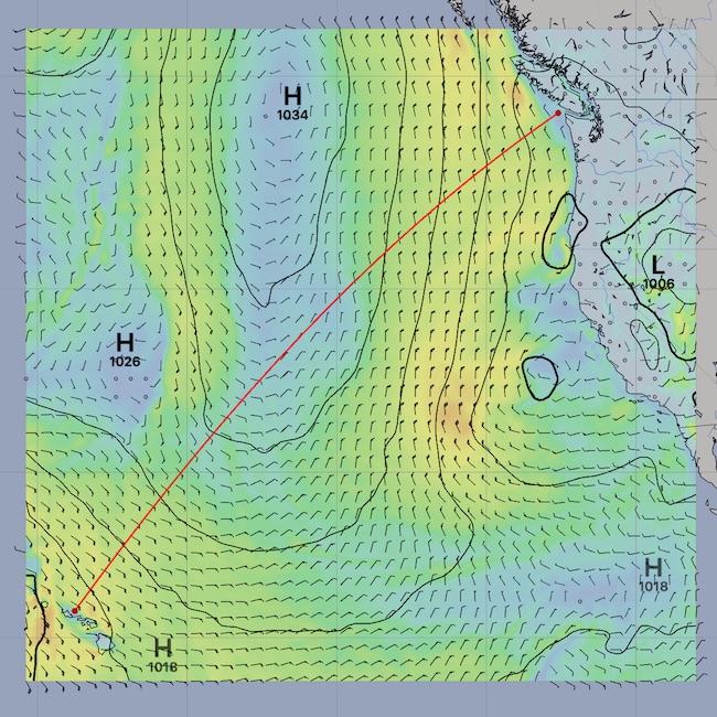
With very little effort, the LuckGrib Weather Routing system can be used to generate an optimized path through this weather system, from Hawaii to Neah Bay:
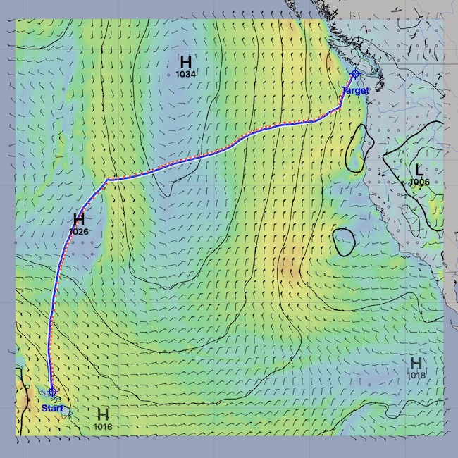

Note that in this case, the optimized weather routing path generated generally follows the rule of thumb, heading north and turning east. However, the system was able to determine that the forecast has a favorable approach to Neah Bay from the SW due to WSW winds at that point, at the time the vessel is approaching the area. Of course, if you were to sail this route, you would update your weather forecasts at least daily, and as you approach the decision point for the turn east you would have fresh data to help with that decision.
Wind barbs are being shown along the route generated, which allows you to easily see the wind directions which are forecast.
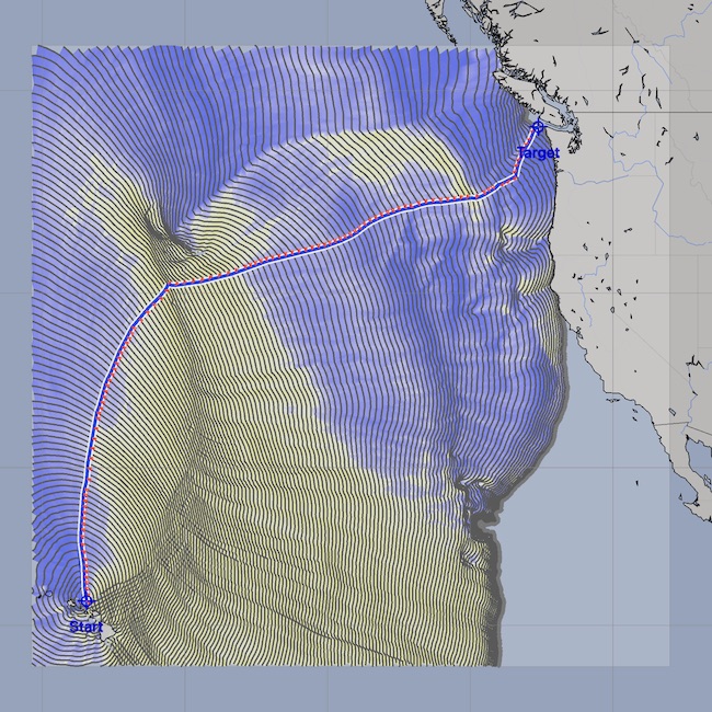
In the image on the right, an analysis image, the full solution space that the weather routing system created, is being used to show the true wind speeds, for all potential positions you could be at after leaving Hawaii and sailing in all directions.
The color at each position in the analysis image is found by advancing the GRIB time to the time the vessel would be there, evaluating the wind conditions, and then assigning a color based on the wind strength. You can think of this as being similar to a meteogram, although across an area rather than at a point or along a route - the image is showing the weather system conditions at your vessel as you would move through it. (This will be described in more detail later.)
Reading the wind speed analysis image on the right, we see nice wind speeds when leaving Hawaii, with a short interval of strong winds (oranges, ~27kts) a little while after leaving. After that patch, winds calm down. The blue patch is light winds, around 7 kts in this case, and the boat has slowed down. This corresponds to being close to the center of the high pressure zone. After a brief interval, the winds return and are good for the remainder of the trip.
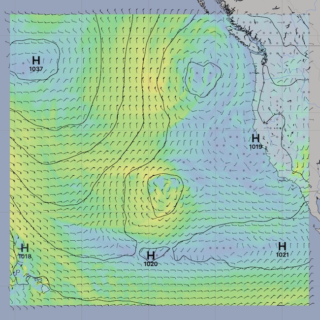
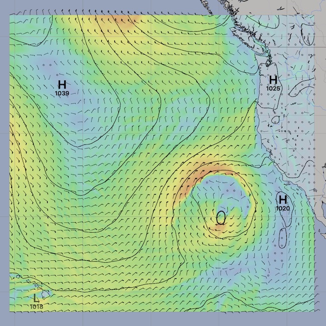
There are more analysis image types available. Here are two more:
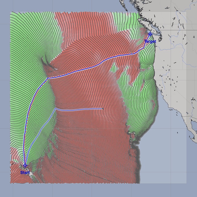
On the left, blue represents downwind, yellow upwind. This is showing that the winds are slightly behind the beam heading north, some upwind sailing as the high is approached and passed, then a downwind ride into Neah Bay. The image on the right is showing winds on the port in red, starboard in green. That image is showing this passage starts with starboad winds, then a tack with winds now on the port followed by several jibes as Neah Bay is approached.
Remember the goal of this system:
I hope you see the promise of this system. There are many more ways that the system helps you to understand what it is showing you, along with many ways for you to tune and control what it is generating.
But first things first - the weather routing solution space is mentioned above. What is that? Please read on.