LuckGrib has several global weather models. When you are close to shore, there is often more than one regional, high resolution, model to choose from.
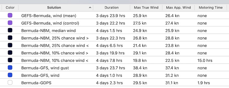
The weather router can process wind data from multiple GRIB files. In this example, the solver is processing:
- GFS, 10m wind and wind gust
- GDPS/GEM wind
- NBM Oceanic probability wind
- GEFS average (mean) and control wind
(Note that the ECMWF (Euro) model is now available through LuckGrib, and should also be used in this type of comparison.)
In this example, the RTOFS ocean current model is being used to help navigate through the Gulf Stream. This is a route from Chesapeake Bay to Bermuda:
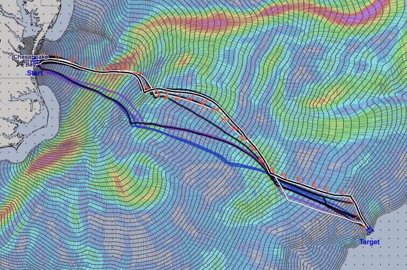
(Note that the solver was asked to stay 20nm away from land for these solutions, which is why the isochrones avoid the banks to the north and south by such a large margin.)
The color image is showing the ocean current velocity encountered by the solution using the NBM Oceanic mean wind field. All of this forecast data was downloaded at the same time. It’s interesting in several respects. The uncertainty of the forecasts is highlit again - all of the solutions use the same current field, however some of the solutions find a faster solution by riding the current and some find a faster route crossing the stream more directly. This again, shows that the results generated can be sensitive to the input data and that, if possible, you should try to evaluate more than one model as you use the system.
Here is a more detailed view of the start of the passage:
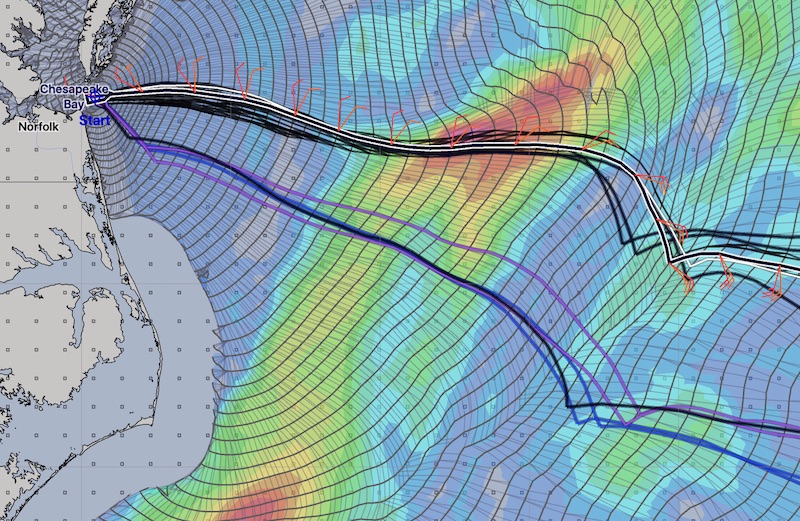
The solutions above were generated with a departure approximately 6 hours after the start of the forecast data.
Note that there is not always such a wide range in the solutions. With this same data, if the departure time is delayed, here is another family of solutions:
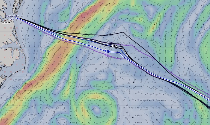
That’s a much closer clustering of results, suggesting there is greater certainty in those paths.