It is generally accepted that numerical weather prediction has advanced to the point where the first several days of forecast data is pretty reliable. The global forecast system, GFS, can produce forecast data for up to 16 days. Nobody should rely on the 16 day forecast accuracy. It is simply not possible to create accurate weather forecasts this far into the future.
However, when in the initial pre-planning stages of a long ocean passage, it is often useful to use even inaccurate forecast data so that a weather route can be created.
A weather route generated through inaccurate forecast data can help with questions such as: roughly how long will this route be? What are some of the possible shapes for the route? The generated route should not be used for your short term tactical decisions, they are only useful as a pre-planning aid.
For example, sailors who sail from the mainland of the USA to Hawaii, or back again, in a normal cruising boat, will typically take longer than 16 days to complete their passage. When doing rough, back of the envelope planning, it would be nice if the weather routing system had access to a sufficient amount of wind data so that it could complete most of the potential sailing routes.
Climate forecast data
NOAA has been running a Climate Forecast System for years. This model is meant to provide seasonal guidance.
The CFS produces six months of forecast data. A note on the word forecast: nobody would use this model to provide guidance for what the conditions will be at a place and time, far into the future. However, this model does create realistic weather systems, starting with the current atmospheric conditions, extending out six months. While the CFS data should not be used as a forecast to answer questions such as “what will the weather be at some far future point in time”, it will produce realistic transitions from day to day, with one weather system changing dynamically into another.
There are no forecast systems available which can create accurate forecasts six months out. What will the winds be, at some arbitrary point, 5 months from now? Who knows. However, if you want to explore traveling through a somewhat realistic potential weather systems, far into the future, this model can provide a source for that weather data.
This CFS data can be useful in the pre-planning stages of a passage. When doing actual departure planning, or when making decisions while underway, you will NOT be using the CFS data. Use one of the other weather models to help with actual navigation decisions.
Examples using CFS data
None of these examples present actual routes you can expect to sail. However, they may suggest things to think about. If you create a suite of variations based on this data, you may start to see a reasonable spread of routes.
These routes are for a somewhat typical cruising boat, leaving San Francisco for Hawaii. The route using GFS runs out of wind data before the boat is able to arrive at the destination. When using the climate data, the WR solver is able to calculate a route to the destination, as CFS has six months of data available.
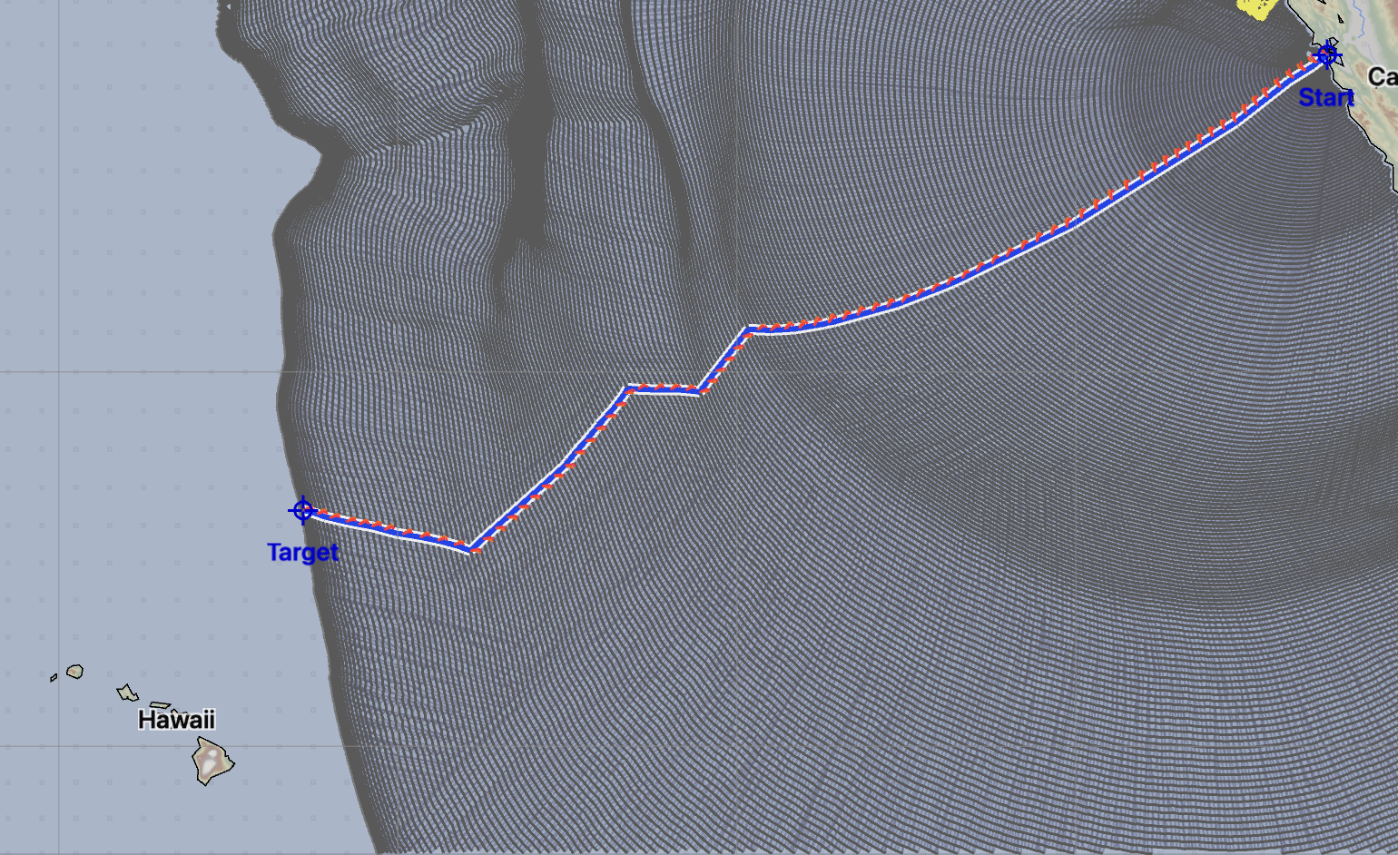
Note, that in the case above, GFS ran out of wind data at 16 days without arriving. CFS arrived in just over 15 days. Clearly, the first 16 days of GFS and CFS are not an exact match. Which is right? Neither is - it is not possible to accurately forecast 16 days into the future.
The CFS data is not useful as a prediction of what route you will follow. However, it can be useful to discover some trends or possibilities.
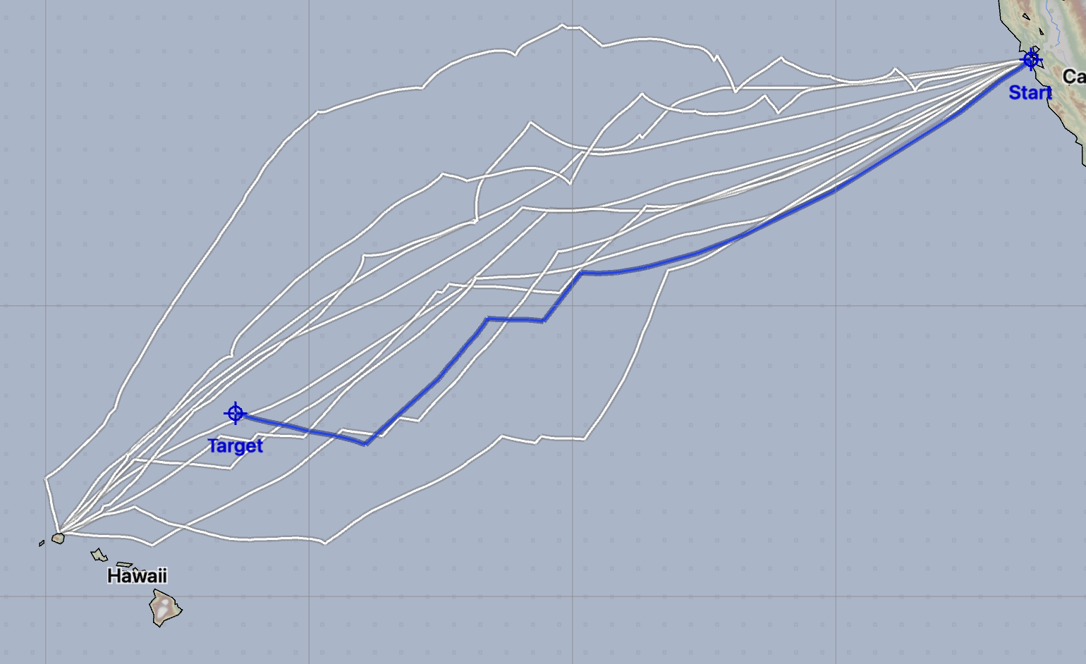
The image above is now showing 10 departures from San Francisco, departing every two days. The range of the results is now starting to span a route you may actually sail. The range of passage times is from 15 days 6 hours to 20 days 17 hours.
This is a popular sailing route. The Singlehanded Transpac race runs every two years on this route. If you look at the results in its monohull division, the span of passage times found in the routes above seem reasonable.
Around Hawaii
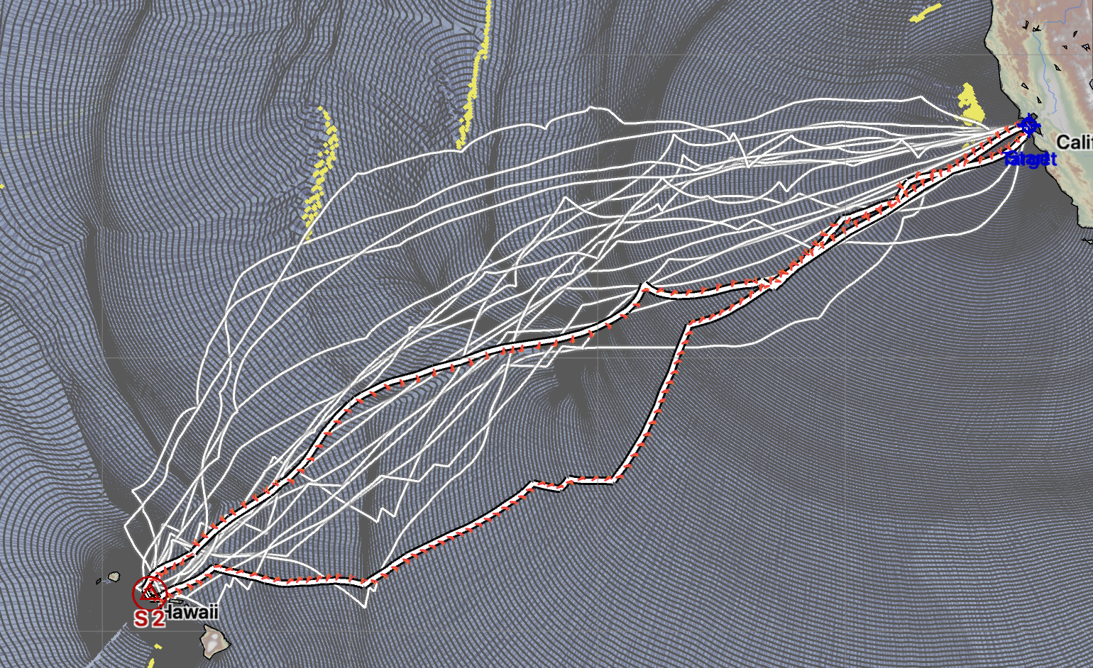
In the example above, ten routes which leave San Francisco, sail around Hawaii and then return are shown. These routes take from 33 to 40 days.
New Zealand to Hawaii
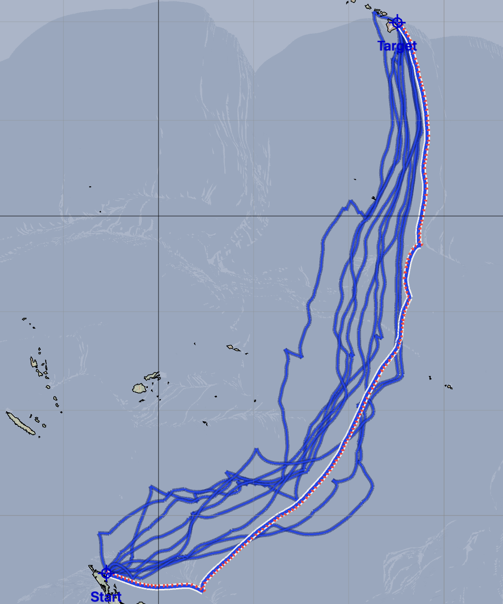
The image above is showing 10 routes between the Bay of Islands, NZ to Hilo, Hawaii. These routes are unconstrained, the router is finding what it thinks of as the optimum routes for 10 different departure dates. These routes range from 37 to 45 days in length.
(Note that the vessel has set the minimum sailing angle to 55° apparent, not wanting to bash into the wind for the duration of this passage.)
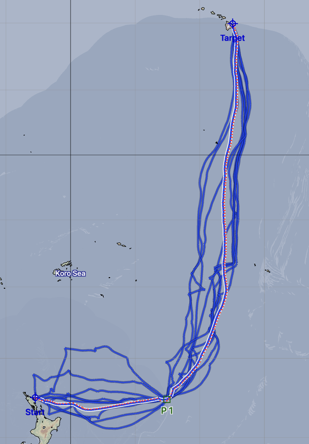
It’s interesting that, while these routes do not follow either path shown in the strategy and tactics section, they seem to favor the general route where you leave NZ, head east and then eveutually turn north to Hawaii.
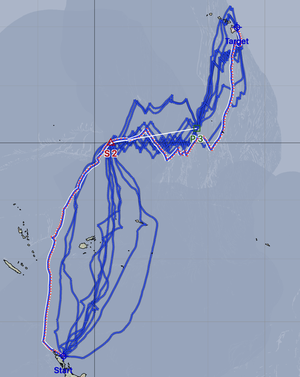
Here are some solutions where the southern route is being enforced through the addition of a constraint point in the SE corner, which must be left to port:
There are ten routes shown, which range from 43 to 57 days. Note that all of the routes passed very closely to the constraint point, which suggests that there are faster routes available if the point is relaxed.
Some of the routes shown above clearly represent departure times that are unfavorable, while other routes start out quite well. The weather systems around New Zealand are migratory, flowing from the West to the East in a series of highs and lows. This type of routing ensemble would be a useful way to study the timing for when to depart with respect to the highs and lows.
The performance of the boat shown is roughly equivalent to my sailing vessel Luckness. I sailed this route in 50 days. It would have been very nice to have had access to these tools before my departure.
Lastly, I was curious about the more northern route. Two constraints have been created, one of which is left to starboard and one of which is left to port.
You could experiment with the constraint points for these routes, moving the first point further north, east, west, etc, as well as the second point, looking for a better suite of solutions. The solutions above range from 52 to 62 days.
Sydney to Bermuda
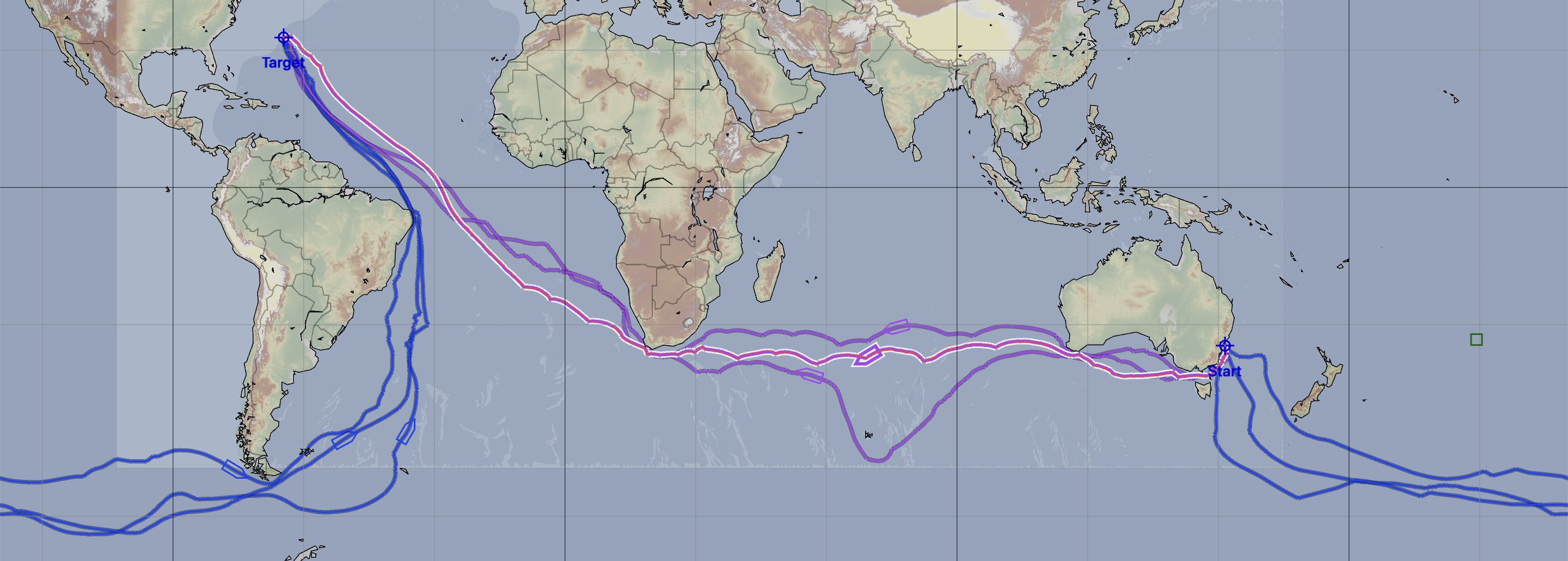
Just for fun, here is an experiment running routes from Sydney to Bermuda. This is for a fast boat.
The three departures are spaced two days apart. Many more would be needed if you were actually considering this route.
The routes which leave Sydney and head West take from 57 to 60 days. The routes which leave and head East range from 46 to 50 days. (Remember, this is a small sample.)
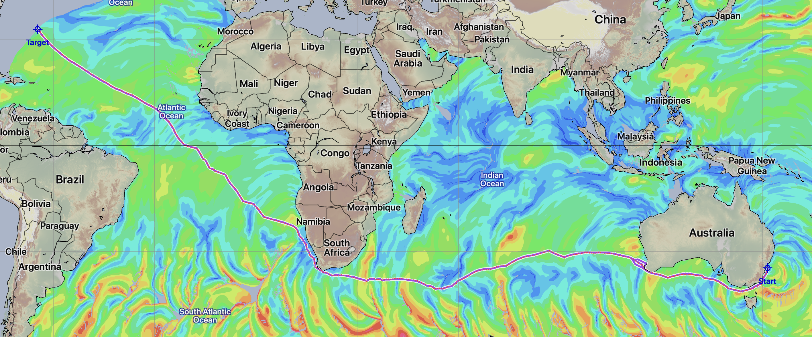
The image above is showing a single unconstrained route for a slower cruising boat. The route shown takes 120 days. The colors are showing true wind speeds encountered along the way.
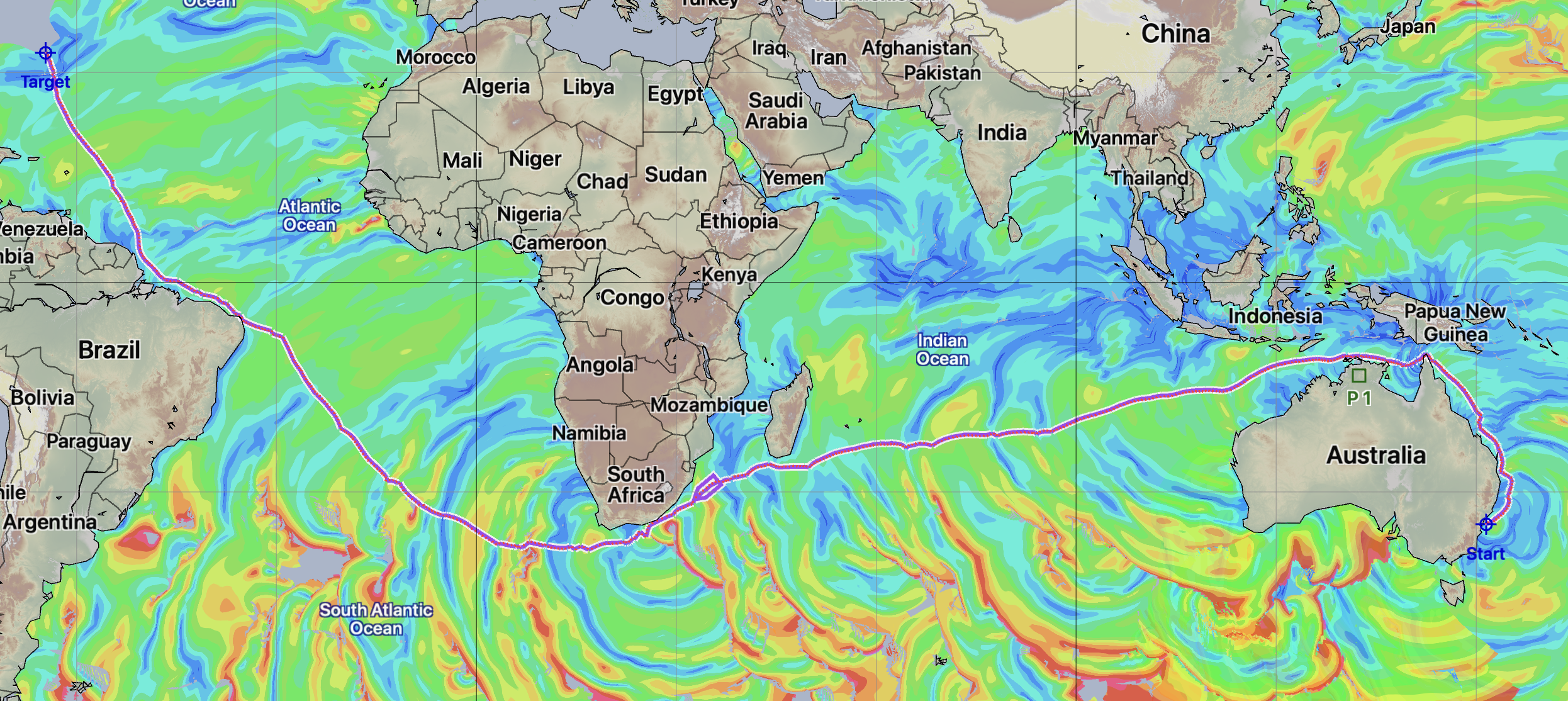
Lastly, the image is now showing a route which is constrained through the addition of a point around Darwin, which must be left to port. This forces the routes to go North around Australia, through the Torres Strait. The route now takes 148 days.
Note that the CFS model contains ocean current data, and the routes above are accounting for this.