While on passage, you will be going through the following process, at least daily:
- download fresh weather data.
- run the solver without a target point.
- examine the solution space.
- decide on an intermediate target point.
- re-run the solver to generate a path.

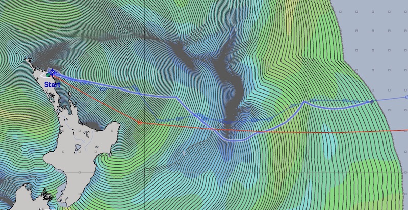
Note from the image above, that the weather route shown, and the actual route I sailed, are a very close match for the first 2 ½ days. At that point the weather route suggested it was better to continue east, but instead I jibed and headed more south. Lets examine that decision in more detail.
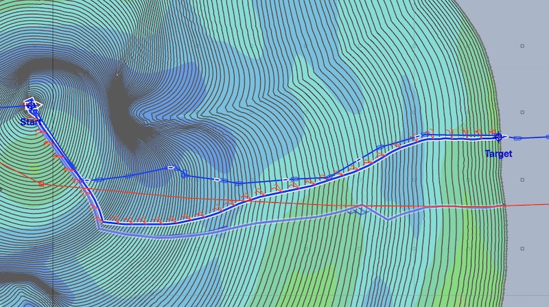
I’ve repositioned the start point and time to where I actually was at that jibe. Using the weather forecast data I had access to at the time, here is the updated solution space:

In this image, I’ve created a target point on the actual track I sailed, and also positioned the cursor on the rough outline of the route I was using as a guide.
Note that the WR path to the target point, and the dynamic path to the route are the same for the first 24-28 hours. This is ideal, as before you need to make that decision (jibe and stay north of the route or continue south and follow the weather router path) you will have downloaded fresh weather data and can reanalyze this problem based on where you actually are at the time.
Additional knowledge.
When choosing intermediate, tactical, target points for the weather router to follow, there is no need to restrict yourself by only considering the weather data you download and analyze.
For example, if you are sailing a passage which is heading into reliable winds, such as the trade winds can be, you should use that knowledge to place the target point so that you can take advantage of those winds.
If an area you will be traveling through has winds which are fairly consistent, perhaps before leaving on your passage, you can study the area and run many routes through it. This should give you a good idea for how you want the initial portion of your passage to join this portion. Of course, you will be reevaluating your initial guess as you approach that decision point.