Normally, when planning a departure for a long passage, you have a destination in mind that you are heading toward. However, for long ocean passages, in the context of the short term tactics, this is not the case.
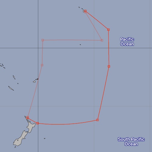
Consider the southern route from the image above. The goal is not to follow the route indicated by the red line.
The best we can do is to choose a favorable departure time, and then, while underway, constantly plan to position ourselves such that we take maximum advantage of the weather forecasts, over and over.
The first step in the departure planning is to generate a routing solution with no target point. For example, this is a solution using weather data from several weeks before Luckness departed NZ:
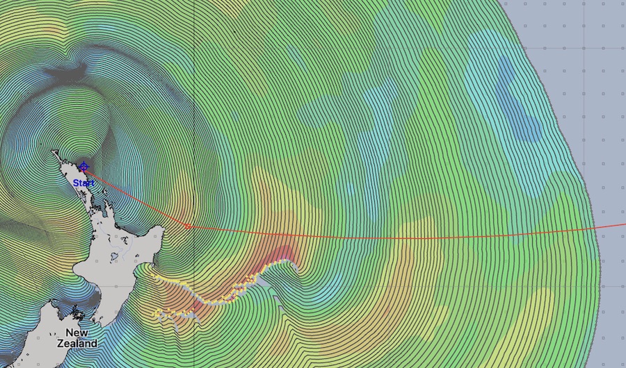
The colors are true wind speeds. The yellow dots represent violations of the maximum wind conditions I had set for the solver (30 knots apparent wind.)
The solver was able to find paths to all of the points in the isochrone solution space shown, while respecting my comfort settings. However, when I examine the GRIB file, there is 40 knots of wind south of the path at 4 ½ days into the forecast. This would be generating larger seas north. (When you see those yellow dots, be careful and examine the GRIB forecasts for those regions of time.)
It seemed imprudent to leave on a long passage, only to be faced with these conditions after 4 ½ days. We could stay farther north of the path, but there is uncertainty on which way the weather system generating those winds would move, it could easily trend north as it moves east which would clobber us if we were in that area. We want enough wind to sail but not so much as to break things.
Here is a second image, from the day before my eventual departure.
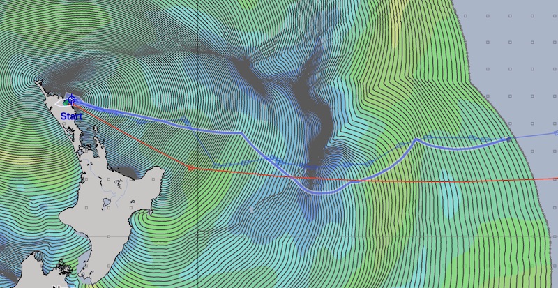
I have turned on the track of my sailboat, Luckness. In this image, I had also placed the cursor at the point where the last isochrone hit the actual route I sailed. (This dynamic path shown follows the cursor, allowing you to explore the paths in the solution space.)
Notice that the isochrones make the furthest progress east, south of the red route indicated, at around 40°S. This is 2° further south than the planned route, which is close enough to consider heading toward that area.
There is nothing worrying in this forecast. At this point, you can choose a target point for the router to head toward, re-run the solver and have it generate a path for you.