There are a number of configuration settings available in the LuckGrib weather routing system which are considered a little more advanced, and are not available unless you turn them on. This is done in an attempt to make the system easier to use. Rather than all of the many setting always being available, you can turn on the ones you need, and have an easier time interacting with the system.
When you enable one of these optional configuration setting, they will appear in the vessel settings editor. Any setting not shown has a reasonable default value.
On the Mac, the application preferences window is accessible through the LuckGrib menu, which has an area related to weather routing:
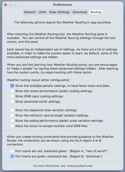 Mac weather routing preferences.
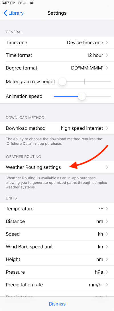
On iPad or iPhone, these settings are available in the sidebar area:
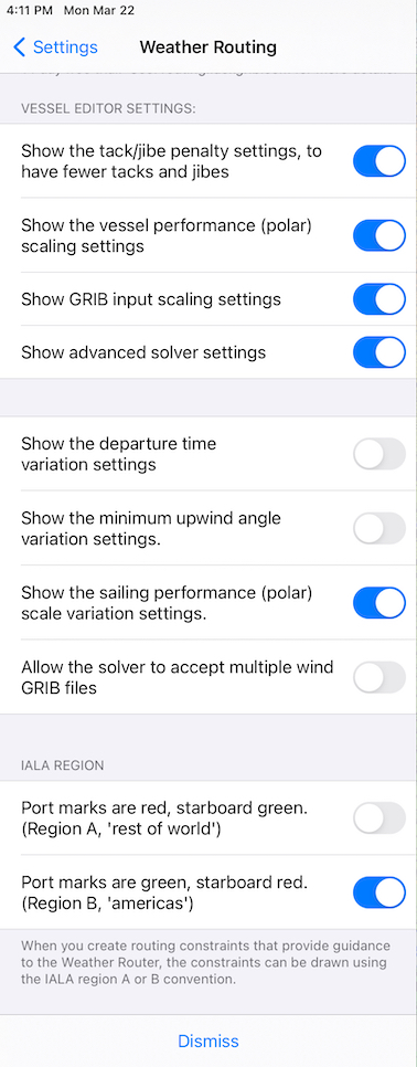
By default, all of the settings are disabled, presenting a useful and somewhat simplified weather routing system. The settings which are shown enabled, above, are a recommended set you can build up to, if necessary, once you have learned the system.
The settings beyond the selected ones shown above are needed less frequently.
All settings are briefly described below. Each of them is discussed in more detail elsewhere in the manual.
Tack / jibe penalty.
By default, the solver does not apply a penalty to tacking or jibing. This is often just fine, but can, on occassion, generate more tacks and jibes than you may prefer. This setting can help tune this.
Polar scaling.
You can quickly scale the vessel sailing and motoring performance up or down. Note that there is always a control available to allow you to apply a scale to the sailing performance at night, which allows you to reef at night, if this is something you do.
GRIB input scaling.
You are able to apply a scaling to the GRIB file values. If you feel that the wind speeds are constantly too low, you can increase them. Or the reverse. If you want to route using a current file but want to deemphasize the effect current has (as you may not trust it) you could scale the current velocities down.
Advanced solver settings.
By default, the solver will find close associated paths which highlight areas where the path is more or less sensitive. The close value can be controlled if you enable this settings.
You can also override the automatic time step that the solver uses when generating isochrones. In the majority of situations, the automatic time step is what you will want to use. If you are sailing in confined waters, you may need to adjust this.
One further control which is exposed when you enable this setting is the ability to have the solver stay north of some southern latitude. This may be useful when routing in the southern oceans.
Departure time variations.
If you are planning a passage and have control over your departure time, these settings can be used to have the solver generate a suite of solutions, covering different departure times.
Minimum upwind angle variations.
If you are curious about what the effect of varying the minimum upwind angle has on a series of solutions, enable this variation and create an ensemble of solutions using it.
Do you need to sail close to the wind to arrive at your destination, or can you fall off the wind and arrive at a reasonable time?
Sailing performance (polar) scale variation.
You can model sailing more slowly by adjusting the polar scale used with the sailing polar. If you are curious about what the effect would be on sailing more slowly, enable this variation.
There are times when slowing down a little will help the outcome. Also, there are times when slowing down a little doesn’t matter that much, and other times when pushing hard toward your destination makes a big difference on the outcome.
If you enable this variation you can create experiments to explore these speed up / slow down options.
Multiple wind files.
If you have wind data available in more than one wind file, perhaps GFS, GEFS and NBM Oceanic for example, you can instruct the solver to accept more than one wind file.
IALA Region.
The constraint sequences that can be accepted by the WR solver contain a series of points which are left to port or left to starboard. Each of these points is named and displayed using the day mark navigation aid convention. Port marks are shown as a squares (cans) and given odd numbers, starboard marks are drawn as triangles (nuns) and given even numbers.
In addition, the marks are either red or green. The convention for the colors changes, according to the IALA rules in the region you are sailing. You can set the region here.