(This example follows on from the previous Combined topic.
Each day, while on passage, you will be updating your vessels current location by creating a new position report, downloading new weather data, and updating your weather routes.
Here is an updated position report, following on from the previous page.

Note that the actual position is not exactly on the isochronal weather route. Neither the weather forecasts, or the model of the vessels performance (polar diagram) will exactly match reality. Close is about all you can expect. This is a good match.
If the position report was far off the projected path, then you could evaluate if adjusting the polar diagram would be warranted. You will want to iterate slowly, over time, making improvements to the polar diagram.
Updated weather and paths.
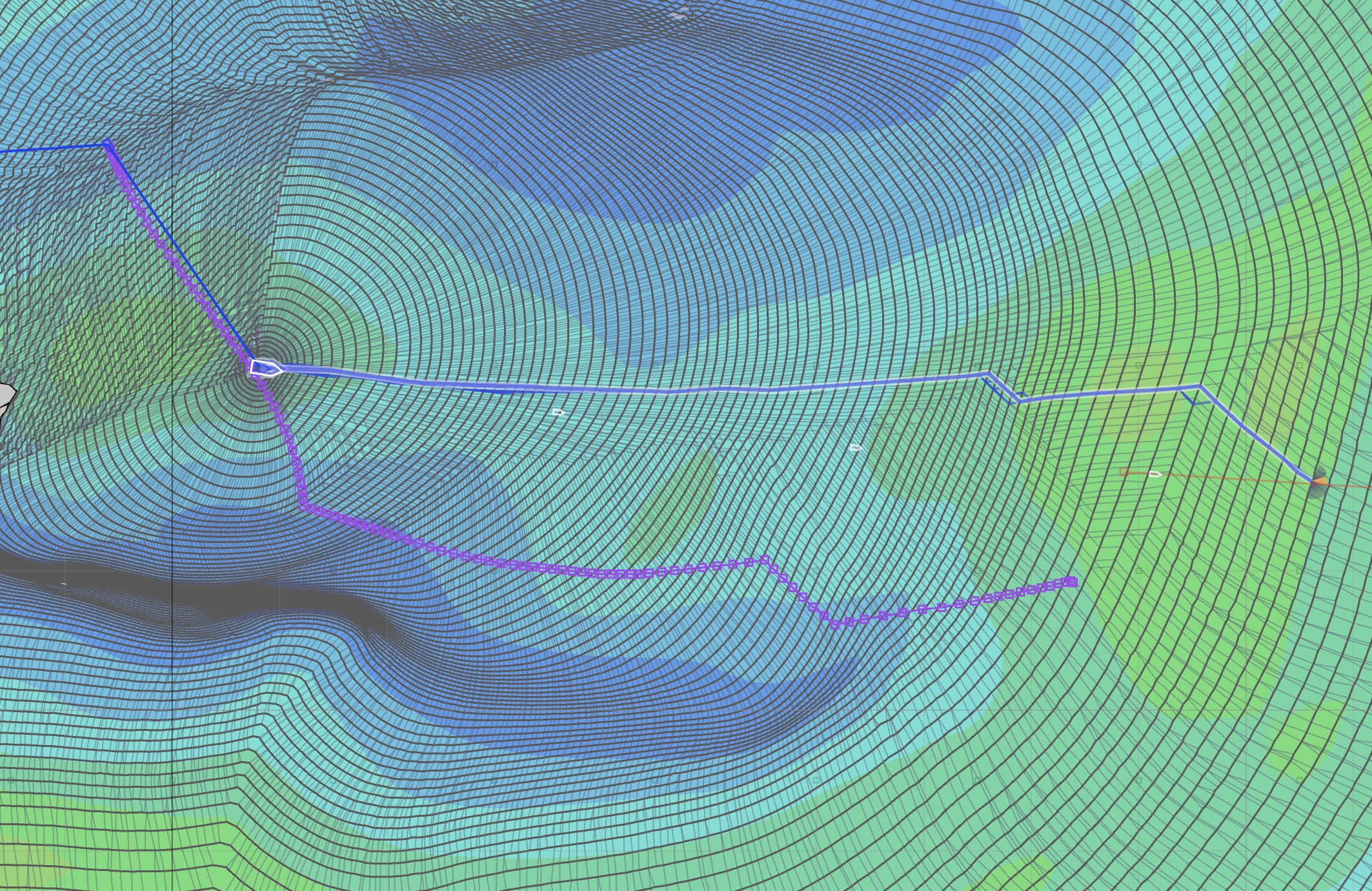
After downloading fresh weather data, a new weather routing solution space was created. This is now showing a different solution from the previous days routes.
 Cursor at previous target.
With this new weather data, the system is now calculating that there is a better route to the target point used in the previous example. Here is a second image with the cursor closer to the strategic route:
 Cursor on route.
This highlights that, all we can do is make the best tactical decisions we can, at the time, with the best data and algorithms available. Weather forecasts change over time, and always contain uncertainty. This is just the way it is. This forecast is showing a patch of light wind has moved north from the previous forecasts. This has pushed the optimized route north, into stronger winds.
Using the new weather forecast data, the newly optimized route is suggesting that it is time to jibe. Both of the above paths have roughly the same short term path. This is, again, ideal. We can follow that short term tactical path, download fresh data the next day and make a new set of decisions at that point.
There is an important point which should be noted. Based on the previous days weather forecast, we made the best decision we could at the time. Now, with fresh data, 24 hours later, we see that it is time to change the plan and jibe. What we don’t know is: was there a better route that we missed? Updating your weather data more frequently when in areas where the weather systems are changing rapidly is encouraged.
Choose new target, update attached path.
After analyzing the full solution space, just as before, an intermediate target is created and the solver run again to generate a path.
This new path can now be associated with the vessel again:
- save the WR solution as a route
- open the vessel editor and associate this new path with the vessel
Accumulating saved WR paths.
You may want to retain a small number of historic WR paths to compare. It may be useful to save two or three old paths, to see how the forecast is evolving.