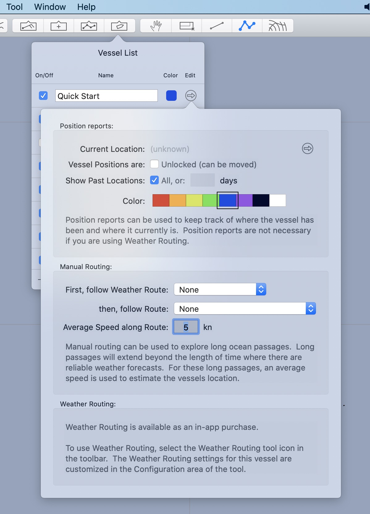
You edit the properties of a vessel using the Vessel Editor:

Undo is supported for all of the following operations.
Position reports.
Vessels may contain a list of position reports. Position reports can be used to keep track of where a vessel has been (its track) as well as experiment with where it may be in the future (position reports with their time set into the future.) Position reports are described in more detail in this section as well as in the Manual Routing section of the user manual.
You can view the list of position reports by clicking on the reveal button to the right of the current location line.
Locked position reports.
If you are keeping track of where a vessel has been, it is often convenient to lock these positions so that they are not accidently modified.
Show past locations.
If you have several years of positions reports represented in the system, you may not always want to see the entire track. You can choose how many of these past position reports to show.
Color.
You can choose the vessel color here. Note that the vessel color is used as the base color for both its track and any generated weather routes.
Some of the colors have more contrast than others. Choose accordingly.
Manual routing.
Manual routing is described in more detail in its own section of the manual.
Briefly, vessels can follow both weather routes and manual routes. It is possible to attach a generated weather route to a vessel using the weather routing tools menu. As you change the GRIB time, you will see the vessel track along the attached weather route.
Once the GRIB time advances beyond the end of the associated attached weather route, or if there is no attached weather route, then the system will project the vessel along the indicated route, according to the average speed that has been set.
Manual routing is one way for you to explore long passages. If a passage is much longer than available weather forecasts, manual routing can be used to let you experiment with possible paths to follow.