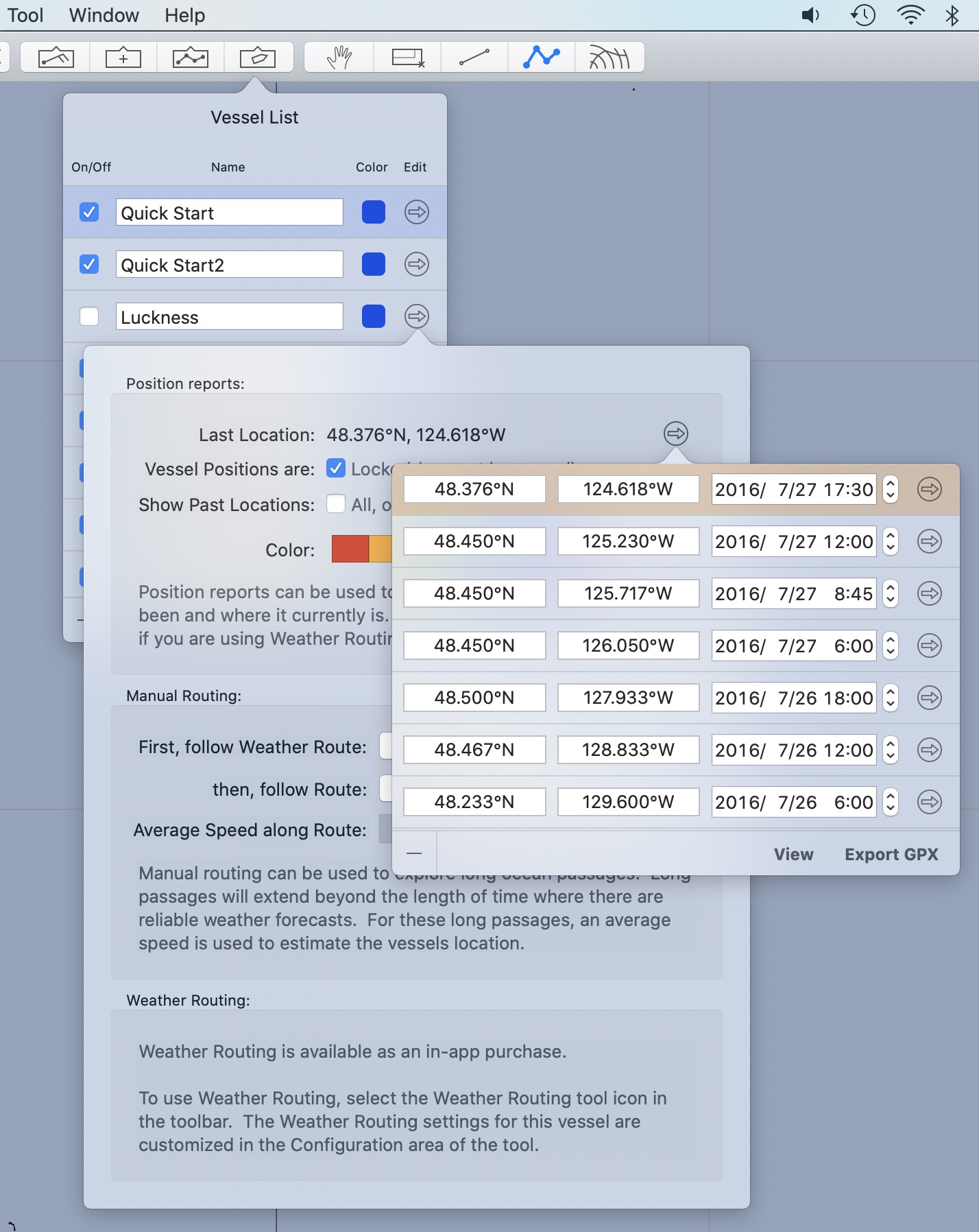
Position reports are drawn, if the vessel has not been hidden. Each vessel can determine how many of its past position reports are drawn, as described in the editing section.
To view the list of position reports for a vessel, click the reveal button to the right of the location line in the vessel editor.
Undo is supported for all of the following operations.
Deleting a position report.
Position reports can be deleted by first selecting them, and then clicking the - icon in the bottom left of the window.
More than one position report can be deleted at once, by selecting more than one report. Multiple selection is done through the standard mechanism:
hold the command key down while selecting an item to add or remove that item from those selected.
hold the shift key down to extend the selection range to include the item you click on.
Note that you must click in the rows background in order to select it (avoid clicking in the text fields.)
You can also delete a position report using the Points and Routes tool, using the menu available on a position report when that tool is active. The Manual Routing section of this manual has a discussion on this.
Modifying an existing report.
You can modify the latitude, longitude or time of a position report by editing the appropriate field. Note that if you edit the time of the report, the report may be reordered within the list.
There is another editor which can be used to edit the position report details:
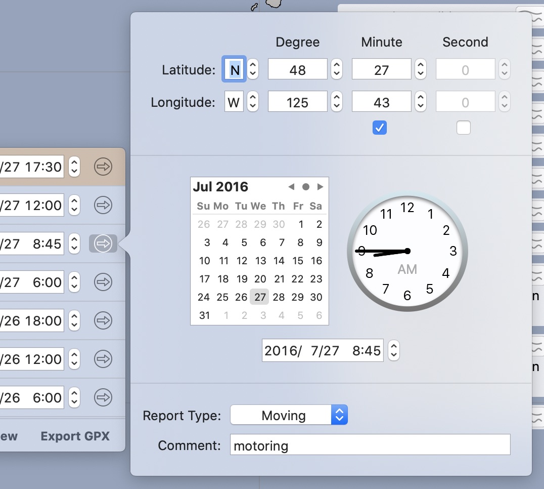
The position report type field is used with the manual routing process, to indicate the positions which represent the start and end of a passage. These start/end passage marks allow the manual routing system to generate statistics for each passage.
View reports.
There is a view button at the bottom of the position report list. This can be used to copy/paste the position reports in a readable report.
Note that the format of the position reports in the view report generated, is compatible with the Points editor. This can be used, for example, to copy all of the position reports from one vessel to another.
Export GPX.
You can export the list of position reports in the GPX format. There are many other software systems which are able to import GPX format files.