
Using the manual routing system, you are able to perform your own weather routing. This has been used, successfully, to help sailors on many passages, world wide.
If your passages are relatively short, you may not need to use this manual routing process. Combining the techniques outlined below, with the isochronal weather routing solver, is described in Combined routing.
This page describes some of the techniques that are available to help with the manual routing process.
Associating a route with a vessel.
Creating a vessel has been described in this manual, as has creating and editing a route.
The route you create should roughly outline the long passage you have planned, in fairly minimal detail.
The way you combine the route with the vessel to perform manual routing is through the vessel editor:
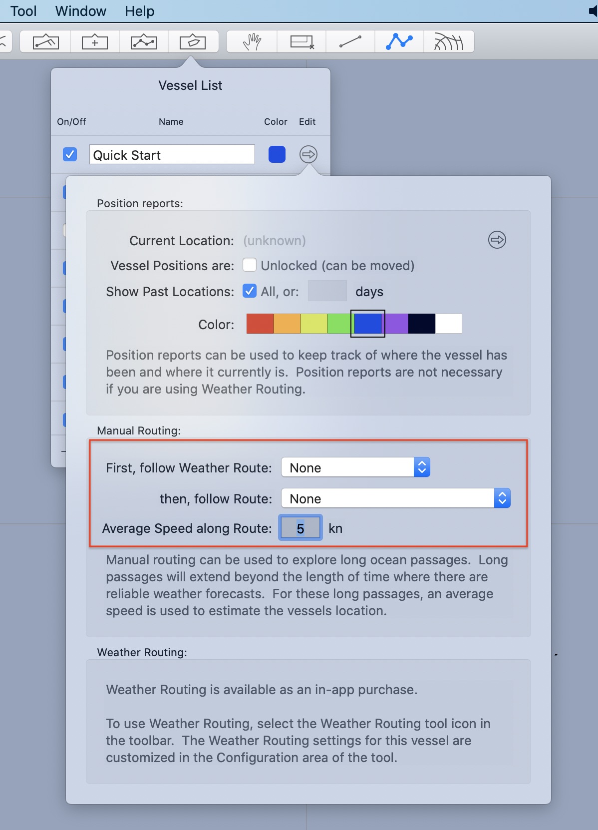
Change the menu beside then, follow route to indicate the route you created and want the vessel to follow.
You also need to decide on the average speed the vessel will use. Type this value into the editors average speed field.
After setting the vessel to follow a route, you will see something like this:
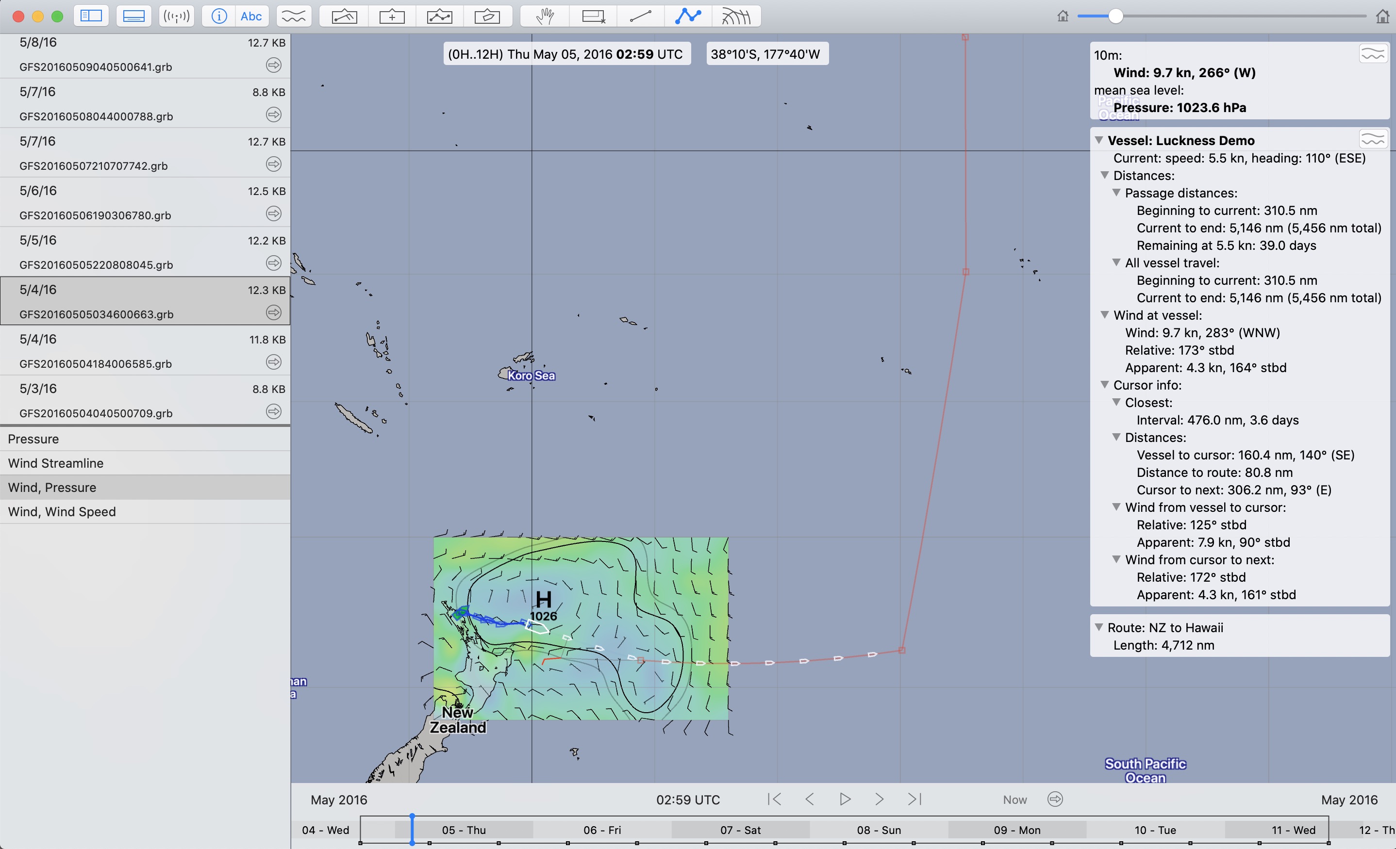
(Click on the image to see more detail.)
Note that:
- the larger white vessel icon is the projected vessel location at the indicated GRIB time. As the time changes, so will the vessel location.
- the smaller vessel icons in front of the larger icon are each projections 24 hours in the future from the previous icon. 10 days of projections are being shown.
- the text information in the top right shows various information for the vessel as well as while tracking the cursor. As with previous text windows, the triangle icons can be used to collapse or expose these groups as you want.
Also notice that there is a meteogram button in the top right corner of the text information area.
Meteogram.
A sample of the meteogram available for a vessel is shown:
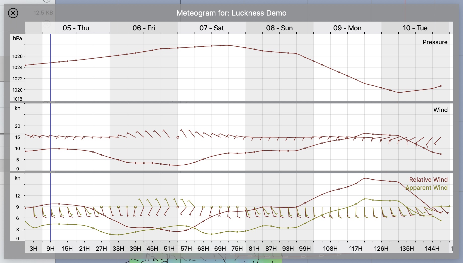
Note that this meteogram will show all of the available GRIB parameters, including, when available, pressure, rain, simulated radar, etc. The meteogram shown when in the weather routing tool, only shows the parameters the solver referenced (boat speed, wind, wave height and current.)
Adjusting the route through weather.
It is quite easy to move and insert route points. You can do this to shape the future path of the vessel through the weather. You can do this while watching the text information, or meteogram, and modify a position until a wind angle represents what you want.
This manual weather routing process is available to you. However, with the introduction of isochronal weather routing, this manual process will likely be used less frequently for the short term tactical decisions.
Manual routing remains useful to allow you to reason about long passages, passages that are longer than you have reliable weather data for.